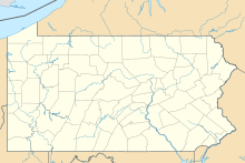
Indiana, Pennsylvania
Borough in Pennsylvania, United StatesIndiana is a borough in and the county seat of Indiana County, Pennsylvania, United States. The population was 14,044 at the 2020 census. It is the principal city of the Indiana, Pennsylvania micropolitan area, about 46 miles (74 km) northeast of Pittsburgh. It is a part of the greater Pittsburgh–New Castle–Weirton combined statistical area, as well as the Johnstown and Pittsburgh media markets.
Read article
Top Questions
AI generatedMore questions
Timeline
AI Generated- 1805Indiana was founded as the new county's seat from a grant of land by Founding Father George Clymer.
- 1810Indiana had a population of 125.
- 1843The Clarion of Freedom was founded.
Nearby Places
WMUG-LP
Radio station in Indiana, Pennsylvania
WFSJ-LP
Radio station in Indiana, Pennsylvania

Indiana Armory
United States historic place

Indiana Borough 1912 Municipal Building
United States historic place

Silas M. Clark House
Historic house in Pennsylvania, United States

Breezedale
Historic house in Pennsylvania, United States

James Mitchell House
Historic house in Pennsylvania, United States

Downtown Indiana Historic District
Historic district in Pennsylvania, United States


